World Map With Country Borders (huge map)
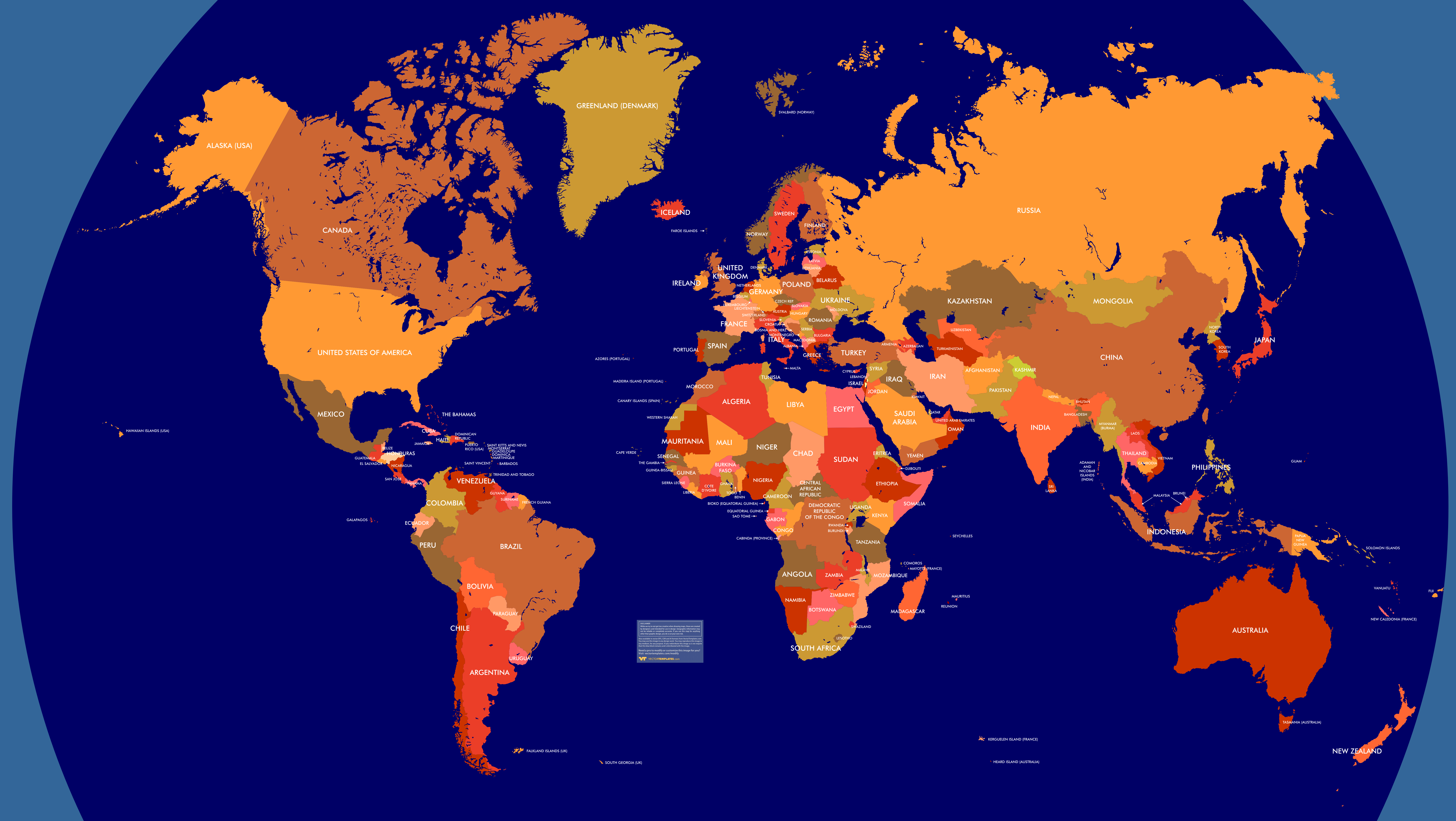
Title: World Map With Country Borders (huge map): Free Download
Tags: huge world map very detailed continents countries country names
Price:
Format
The download is a single, 300 dpi, PNG file ( 7408 x 4176 pixels ).
Additional Formats
If you need this image in another format, such as PSD, PDF, etc. please contact us.
Acceptable Use
As long as you do not use this image to compete with VectorTemplates.com, you may use it for any purpose, forever. Please see the license agreement for details.
Attribution (How to say "Thank you")
If you use this image on your site or in your publication, please mention VectorTemplates.com as the source. A link to VectorTemplates.com is not required, but links are always appreciated.
About Author
VectorTemplates Team
Now get access to an extensive collection of unique templates and themes. VectorTemplates lets you discover the best WordPress themes, web templates, and more. All the themes and templates work great for any design and business site. You get free vector in ai, eps, cdr, SVG illustration graphic art design format.